|
Are the so-called impact
craters in Mauritania kimberlite pipes ?
Aouelloul, Tenoumer
and Temimichat
|
Norbert Brügge, Germany
Dipl. -
Geol.
mailto: [email protected]
Upload: 2013
Update: 16.04.2020

|
|
Geology of Mauritania
Mauritania comprises four major geological domains. The central
part of the Reguibat Shield - an uplifted part of the
West African Craton which has been stable since 1700 Ma and dominates
the northern third of the country's surface geology.
The N-S Mauritanides Orogenic Belt. The western margin of this orogen
is concealed beneath coastal basin sediments.
The western part of the Taoudeni Basin infilled by Neoproterozoic
to Devonian sedimentary strata unconformably overlying crystalline rocks
of the Palaeoproterozoic to Archaean West African Craton. The continental
to shallow marine Taoudeni Basin does not exceed 5000 m in thickness,
and though it varies somewhat, comprises a remarkably homogenous lithological
sequence.
A western Mauritanian Coastal Basin infilled by Mesozoic-Cenozoic sediments.
Reguibat Shield
The West African Craton
is primarily composed of two shields, the Reguibat Shield in the north
of Mauritania and the Leo Shield in Liberia and Sierra Leone, separated
by the sedimentary (Upper Proterozoic to Palaeozoic) Taoudeni Basin.
The Reguibat Shield dominates the northern third of the country's surface
geology. It constitutes a very extensive portion of Precambrian crust,
bounded on its western side by the Mauritanides Belt and to the south
it is overlain by late Precambrian sedimentary rocks of the Cambro-Ordovician
and Devonian series.
The Reguibat Shield is divided into two main parts:
The eastern shield or 'Eburnean terrane', with ages of 2000 �200 Ma
corresponding with the Birimian tectonothermal events and predominantly
comprising intrusive granites in the west and volcanic formations in
the east.
The western shield or 'Archaean terrane' mainly with ages of ≥2500 Ma
and predominantly comprising migmatites gneisses, granitoids, ferruginous
quartzites and Banded Iron Formation (BIF), amphibolites and feldspathic
gneisses. The highest grade gneissic and granulite terrain is the Archaean
basement located in the western part of the shield in the Akjoujt area
where it outcrops as poorly granular, migmatic felsic gneiss and coarsely
foliated orthogneisses.
Taoudeni Basin
The Taoudeni Basin has experienced
only one period of modern oil exploration. Agip and Texaco were each
awarded blocks in 1970 with seismic and in 1974 with two drillings.
The Taoudeni Basin is a broad intracratonic sag which appears to have
formed in response to the Pan-African Orogeny. The basin initiated in
the Infracambrian, and continued to develop throughout the Palaeozoic
until the Carboniferous. Despite the proximity of the Pan-African, Caledonian
and Hercynian Orogenic belt, there is no evidence of significant deformation
in the basin. For example, the Hercynian Orogeny, which formed the Mauritanide
Fold Belt, is pinned by a fore-thrust in the eastern part of the fold
belt, and significant deformation does not appear to have propagated
eastwards into the present day Taoudeni Basin.
There are some broad, long-lived structural highs through the basin:
The northeast striking Abolag�Ouasa High compartmentalises the basin
into two depocentres: The Maqteir Depression to the west, and the main
Taoudeni Depocentre to the east. These are broad, relatively unstructured
depocentres, although there are some large features evident in the 2D
seismic data (El Mrayer High).
In southernmost Mauritania,
a Cretaceous rift basin is superimposed on the Taoudeni Basin. This
poorly known basin is only inferred from gravity data. The Nara Rift
is a northeast-striking feature straddling the southern Mauritanian
border.
Diamond &
Kimberlite exploration
In search of diamonds
in kimberlite structures, some companies - Ashton Mining, De Beer
Consolidated Mines, Dia Met Minerals and Rex Diamond Mining - in
the years 1997 to 2003 explored large parts in northern Mauritania by
means of gravimetric and magnetic measurements. It followed also some
drillings on promising targets.
Numerous kimberlite structures were mapped, some of them being diamond
bearing. Unfortunately, mostly of the kimberlites had non economic potential.
The verification of magnetic and indicator anomalies led also to the
discovery of close to one hundred lamprophyre bodies. The bodies are
swarms of dykes. The lamprophyres are highly altered, and some have
affinities with lamproites and kimberlites.
Rex Diamond Mining discovered a site of diamond bearing kimberlite in
1999. This kimberlite is a coarse-grained tuff breccia. Discovery was
based on a 300 meter diameter aeromagnetic anomaly. The pipe is covered
by 1.5 meters of loose dune sand. The top 0.5 meters of the kimberlite
is intensely calcreted with underlying kimberlite containing ilmenite,
olivine, phlogopite as well as ultramafic nodules. A second pipe was
discovered nearby. Both of these pipes are within a still larger, circular
aeromagnetic anomaly indicating perhaps a common, much larger kimberlite
pipe.
In 1999 Ashton reported discovered diamonds and kimberlites from the
Reguibat Shield, and subsequent work confirmed the prospectivity of
the region for economic diamond deposits. Processing of selected drill
samples recovered 78 diamonds and diamond fragments weighing a total
of 2.86 cts.
|
Preliminary remarks
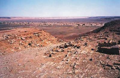
I have not studied the craters at the
place. However it is very uncertain, whether the craters of Mauritania
have emerged by an impact. There are no proofs for an impact. There
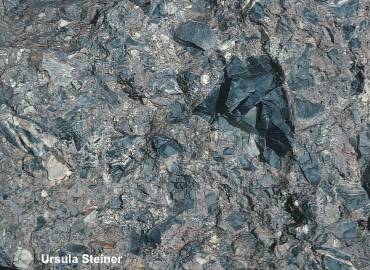
are to find clear proofs for volcanic activities. The breccias on the
crater rims is composed of crushed granitoid, mafic and metamorphic
basement material (Temimichat, Tenoumer) or Paleozoic sedimentary material
(Aouelloul).
The material was changed by high pressure and heat. Magmatic processes
are also responsible for the glassy injections in veins. Polymicte breccias,
glasses and PF's are no unique proofs for an impact event.
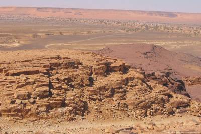
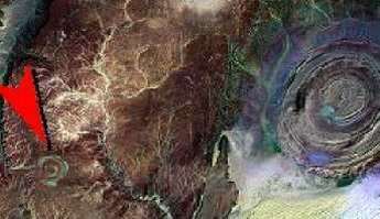
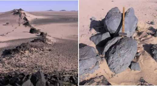
I believe, the craters are subvolcanic plugs. They were lifted up contemporaneously
along an active tectonic line. At the region of Sfariat along such tectonic
faults are mafic dykes and plugs spread. On the top of these structures
the rock layers were erected in the vertical. That is typically for
all structures, which are caused by an uplifted magma. All mafic intrusions
(dykes and plugs/craters) have emerged probably in the tertiary period.
But we can even
guess that our craters are
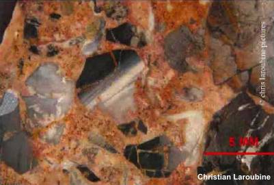
kimberlite pipes.
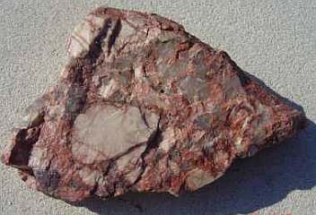
This is pointed by the unusual breccias from the rim of the Temimichat
crater and the regional exploration results of some companies in the
years 1997 to 2003 (see above). Nobody has explored the underground
of the craters by drillings.
The craters could be comparable to just found kimberlite structures
on the East-Sahara-Ghost-Craton (Gilf
Kebir, Egypt). |
|
|
Sfariat: Long
mafic rock dyke ?
|
|
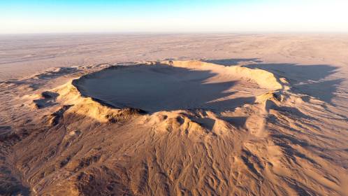
Crater Tenoumer
The 1.9 km wide, almost
circular crater Tenoumer is located in Mauretania, at 22�55'N and 10� 24'W,
about 400 km northwest of the Aouelloul crater.
The age of the structure was initially determined to 2.5 � 0.5 Ma from K�Ar
dating of melt rock (French et al., 1970). Dietz et al. (1969) and Fudali
& Cressy (1976) dated the Aouelloul crater at 3.1 � 0.3 Ma. An age of 1.52
� 0.14 Ma was obtained recently by 40Ar�39Ar step-heating analysis in the
Argon Chronology Facility at Curtin University.
The structure was excavated from a peneplained
surface of Precambrian gneiss and granite that is covered by a thin veneer
of young sediment. The present depth of the crater, measured from the top
of the rim to the apparent crater floor, is about 100 m. The depression is
filled with unconsolidated sediment.
Based on geophysical data by Fudali and Cassidy (1972; also Grieve et al.,
1989), the base above the crater fill is estimated to occur at a depth of
200�300 m. The inner slopes are quite steep (Pratesi et al., 2005, refer to
it being ��locally abrupt��).
Earliest workers on Tenoumer crater favored
a volcanic origin.
Richard-Molard (1948a) referred to the presence of basalt lava and pumice
and suggested a volcanic explosion. Allix (1951) was the first to propose
an origin by impact but failed to present conclusive evidence for this. The
occurrence of a swarm of small ��dikes�� supposedly comprising ��rhyodacitic
lava��, intrusive into concentric fractures around the crater or outcropping
just outside the crater rim, was interpreted by Monod and Pomerol (1966) as
evidence for a possible volcanic origin of the structure.
French et al. (1970) reported up to 8 sets
of PDFs in quartz grains from obviously strongly shocked inclusions of granite
in the ��lava��. It also contains lechatelierite and diaplectic quartz glass
inclusions, as well as ballen quartz. French et al. (1970) reported some Rb�Sr
isotope data that showed that the melt was indeed derived from the crystalline
basement. Fudali (1974) remarked that the composition of the melt rock does
not correspond to that of the gneisses and granites occurring in the regional
basement but requires a component derived from amphibolite veins and enclaves
found in the gneissic terrain.
In 2002, an Italian team of researchers visited the crater and collected extensive
material for a comprehensive geochemical investigation. Pratesi et al. (2005)
summarized these results.
Besides some detailed petrography of the melt rocks, these authors reported
extensive chemical analyses, including major element, REE, and platinum group
element (PGE) data for melt rock samples and various regionally occurring
lithologies. Major element systematics for melt rocks and lithologies show
that besides felsic granites and gneisses, a mafic component must have been
part of the volume. Mixing calculations of Stoeckelmann and Reimold (1989)
reveal that a definite contribution from mafic sources is required. The melt
rock composition is best reproduced by a mixture of 50% granitoids, 17�19%
mica schist, 15% amphibolite, 10% cherty limestone, and 6% ultrabasite. No
contribution from a meteoritic component could be detected.
Recent analyses of several Tenoumer melt rock samples (bomb and lapilli sized
specimens) derived from the outer, northeastern crater rim were reported by
Schultze et al. (2012) and Hecht et al. (2013). The range of whole rock chemical
compositions is similar to that found in previous studies (Pratesi et al.,
2005) and is clearly due to considerable variation in relative proportions
of more siliceous rocks (mainly granitoids) and mafic rocks. Some mafic clasts
suggest that more or less metamorphosed olivine gabbro is also part of the
lithological composition.
The melt samples are mainly of intermediate composition (andesite to basaltic
andesite), but do show significant amounts of olivine microphenocrysts, ranging
from 5% to 25% of the groundmass, exclusively in Mg-and Fe-rich samples.
Microtextures suggest that clinopyroxene formed after olivine and orthopyroxene.
Furthermore, clinopyroxene formed contemporaneously with or prior to plagioclase.
All textures are typical for fast cooling, as exemplified by atoll-shaped
olivine, or acicular pyroxene and plagioclase. The heterogeneity of the Tenoumer
melt rock samples has two main reasons. Two chemically distinct melt phases,
a Ca, Fe-rich one and a Si, K-rich one, were analyzed in the interstitial
glass matrix.
Tenoumer
impact crater, Mauritania: Impact melt genesis from a lithologically diverse
target
D. Schultze, F.Jourdan, L. Hecht, U. Reimold
and R-T. Schmitt -- Meteoritics & Planetary Science 51, Nr 2, 323�350 (2016).
doi: 10.1111/maps.12593
Petrographic
and Petrologic Description
All melt rocks are composed of 50�90 vol% of aphanitic silicate matrix
containing between 10 and 40 vol% of generally round vesicles, up to 15
vol% of carbonate droplets and schlieren, and 1�10 vol% lithic and mineral
clasts.
Felsic granitoids are the most common clast lithology. Dark-brown clasts
that are revealed in thin section to be derived from olivine-bearing gabbro
are found in some of the samples. The larger lithic clasts show obvious,
yet different degrees of partial melting and assimilation into the melt
matrix. Aside from the lithic clasts, there are also macroscopically visible
monomineralic clasts (mineral fragments), mostly quartz grains.
Based on specific melt matrix coloration and transparency, variable vesicle
content, distinct appearance of carbonate phases, and clast components,
the melt rock samples can be subdivided into three groups by macroscopic
criteria alone.
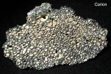
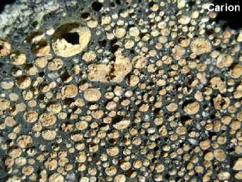
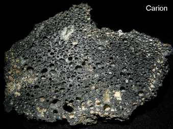
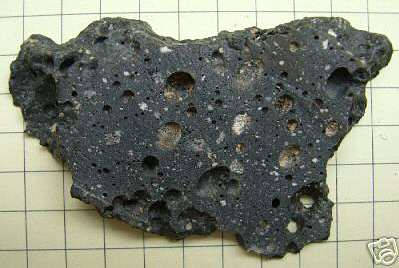
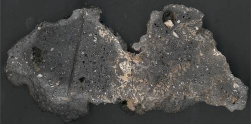
The first group (T1) is reminiscent of volcanic scoria with an entirely
opaque, black melt matrix and up to 40 vol% vesicles that vary in size
and shape (Fig. 2a). Most (ca. 95%) of the voids are <0.5 mm in size and
spherically shaped, only 5% are larger and are usually deformed. Randomly
distributed carbonate schlieren or round droplets >0.5 mm occur at <5
vol% (Fig. 2a). The proportion of lithic and monomineralic clasts varies
between 5 and 10 vol%. The generally rare olivine-bearing gabbro clasts
are mainly found in this melt rock type.
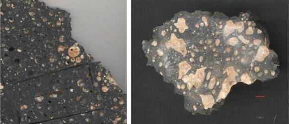
In the second group (T2), the melt rock is composed of a black, glassy,
and lustrous melt matrix, containing generally <10 vol% of spherical vesicles
(<1 cm in size). Some samples of this type contain up to 20 vol% of spherical
or deformed droplets composed of heterogeneous, beige to yellowish-white,
fine-grained carbonate. Only minor amounts (<5 vol%) of granite or gneiss
clasts are present.
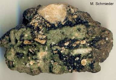
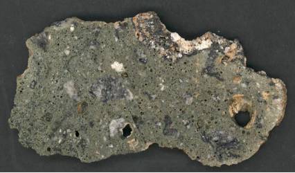
The sample representing the third group (T3) shows a lustrous, light green
matrix that contains around 30 vol% of mostly spherical vesicles. Carbonate
droplet content is below 5 vol% and the droplets are composed of small
(<100 lm), spherical crystals of calcite (often single crystals). The
melt matrix locally contains black schlieren. Lithic clasts,essentially
granite and gneiss, constitute ca. 5 vol%. |
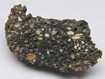
T1: Scoria-like black
matrix containing quartz fragments, carbonate schlieren
sourrounding a granite clast and long altered gabbro clast
|
|
|
|
|
T2: Spherical
carbonate droplets and deformed carbonate vesicles in black glassy matrix
|
T3: Greenish
melt matrix with variably sized vesicles and gneis or granite clasts
|
Progressive
deformation of feldspar recording lowb barometry impact processes, Tenoumer
impact structure, Mauritania
S.J. Jaret et al.
-- Meteoritics & Planetary Science 1�16 (2014)
"Crystalline rocks at Tenoumer are grouped into:
melt-free crystalline rocks of the crater rim and proximal ejecta blanket,
melt-bearing breccia within the proximal ejecta blanket.
Melt-free crystalline rocks include granitic gneiss, well-foliated
biotite gneiss, amphibolite, and highly sheared epidotitized granite.
Melt-bearing crystalline rocks consist primarily of clast-rich melt
rocks of basaltic andesite composition (Fudali 1974). These deposits are commonly
polymict and contain euhedral plagioclase, coherent clasts of crystalline
basement lithologies, an ndividual grains of quartz and feldspar. The variety
of components that occur within melt-matrix breccias reflects, in part, the
complex formation of melt-bearing ejecta.
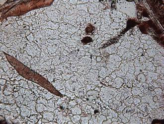
Glass-rich melt breccias contain 1�2 mm amoeboid-shaped bodies of lechatelierite
that show clearly visible flow textures. Ballen silica is commonly associated
with lechatelierite in the glass-rich melt-rocks, where it occurs as both
quartz and cristobalite. In rare cases, ballen silica is isotropic and, with
the exception of the ball-like structure, is indistinguishable from the surrounding
lechatelierite, particularly when viewed in cross-polarized light. By contrast,
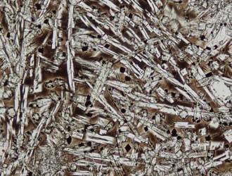
nonglassy impact-melt rocks contain a matrix dominated by euhedral oligoclase
laths, up to 1 mm in length.
Crystalline clasts are common in both the glassy and nonglassy melt-matrix
breccias. Clasts include a variety of rock clasts from crystalline basement
lithologies, as well as individual included quartz or feldspar grains. Distinctly
multimineralic rocks clasts appear to be more common within the glass-rich
breccias. The observed clasts are primarily granitic in composition. Crystalline
clasts, however, are typically small and contain only 3�7 grains.
Clasts of broadly granitic composition could represent components of granitic
gneiss, or fragments of leucocratic bodies within the biotite gneiss. No clasts
rich in epidote or amphibole have been observed."
|
|
|
|
|
Glass-rich melt-matrix
breccia with glass patches, flew textures and clasts
|
Ballen silica and amoeboid
shaped lechatelierite
|
Crystal-dominated melt-rock,
dominated by euhedral plagioclase
|
Chemical
compositions of impact melt breccias and target rocks from the Tenoumer impact
crater, Mauritania
G. Pratesi, M.Morelli, A.P. Rossi, G.G. Ori; Meteoritics & Planetary Science,
Volume 40, Issue 11, (2005)
"The variety of brecciated rocks so far recognized in the Tenoumer area is
quite restricted. The collected Tenoumer samples are all melt-matrix breccias,
containing both lithic and melt components.
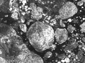
These breccias are dark gray and display a wide range of porosity, with voids
varying in size. Thus, the appearance of the samples may be dense, slightly
vesicular or, more rarely, so strongly vesicular that they resemble a pumice.
In all cases, the void density is probably related to the original amount
of co-existing vapor phase inside the melts.
In particular, no large bodies or thick layers of melt have been observed,
although their presence could be obscured by sand, mainly inside the crater.
The degree of crystallinity of the matrix of the impact melt rocks varies
from almost completely crystalline to clearbrown glass containing only a few
volume percent crystals, although large glass areas are very rare.
Many clasts are granite or gneiss, although clasts of mafic precursor rocks
(amphibolites) can be observed. The size of the inclusions range from 1 mm
up to several centimeters, and many of them show features distinctive of impact
(PDFs in quartz; transformation of quartz to lechatelierite; �ballen�-structured
quartz). Around the inclusions occur chilled areas, where a greater amount
of glass is present. Moreover the glass, which can be clear or light brown,
develops apophyses penetrating the fractures of the inclusions. Where the
inclusions did not retain their original characteristics (such a conservation
only occur in the inner portions of the larger fragments), selective mineralogical
transformation may be developed.
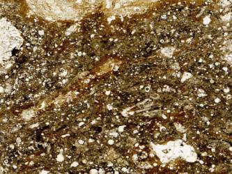
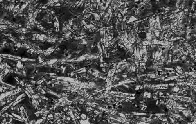
The typical melt rocks consist of a fine-grained intergrowth of plagioclase
laths, pyroxene crystals, oxides, and glass. The texture is intersertal to
aphanitic and there are no features, like alignment of crystals, suggestive
of flow structures.
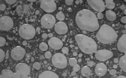
The sample NMNH 113029-15 from the southwestern outer rim of the crater reveals
clear textural evidence for liquid immiscibility between the silicate-rich
glass of the matrix and the carbonates. Calcite, in particular, forms spherules
and globules within the silica-rich glass that sometimes can coalesce totally
or partially. Such textures, sometimes referred as ocellar or emulsion textures,
have been observed in natural carbonatitic igneous. In the past, the presence
of carbonates or sulfates in the impact melt glass has been considered as
being the product of filling by secondary phases.
Analyses of major elements in impact melt rocks show lower contents of SiO2,
Al2O3, and Na2O, and higher contents of MgO, Fe2O3, and CaO, than the felsic
rocks (i.e., granites and gneisses) of the basement. In comparison with the
bulk analyses of the impact melt, the glass is strongly enriched in Si-Al,
whereas it is depleted both in Mg and Fe; moreover, the impact melt rocks
are variably enriched or depleted in some REE with respect to the felsic and
mafic bedrock types. Gold is slightly enriched in the impact melt, and Co,
Cr, and Ni abundances are possibly due to a contribution from mafic bedrock.
Evidences of silicate-carbonate liquid immiscibility, mainly as spherules
and globules of calcite within the silicate glass, have been highlighted."
|
|
|
|
|
Sample consisting of elongated
pyroxene and feldspar laths, opaque minerals and interstitial brown glass
|
Sample, which exhibits
the highest amount of voids
|
Liquid immiscibility
between silicate-rich glass and carbonates |
According to the analysis
data in PRATESI et al. we have clearly an
andesitic melt
|
Oxide
(wt%)
|
MSP 2314 |
MSP 2315 |
MSP 2317 |
NMNH 113029-15 |
NMNH 113029-18 |
NMNH 113029-62 |
|
SiO2
|
58.02 |
62.17 |
58.24 |
60.92 |
60.44 |
61.78 |
|
Al2O3
|
12.51 |
12.60 |
12.42 |
13.41 |
11.08 |
12.51 |
|
TiO2
|
0.83 |
0.74 |
0.86 |
0.39 |
0.65 |
0.77 |
|
MnO
|
0.09 |
0.09 |
0.10 |
0.04 |
0.08 |
0.09 |
|
FeO
|
7.39 |
6.83 |
7.67 |
3.89 |
6.70 |
7.26 |
|
MgO
|
5.68 |
5.17 |
5.94 |
1.85 |
5.04 |
5.26 |
|
CaO
|
6.89 |
5.47 |
6.50 |
7.80 |
7.91 |
5.27 |
|
Na2O
|
3.39 |
3.35 |
3.53 |
3.59 |
2.85 |
3.39 |
|
K2O
|
1.72 |
1.90 |
1.76 |
1.98 |
1.48 |
1.83 |
Crater Aouelloul
|
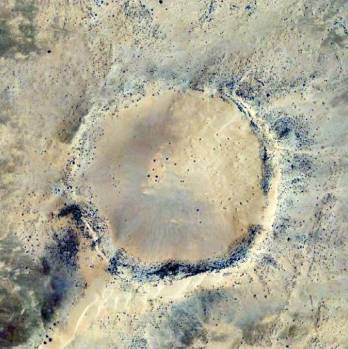
Crater Aouelloul: Latitude 20�
15' N; Longitude 12� 41' W
|
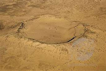
The Aouelloul crater (20�15'N
/12�41'W) is a small bowl-shaped crater with diameter of 390 m. It was
discovered from the air by A. Pourqui� in 1938 and first visited on
the ground in 1950 (Monod and Pourqui�, 1951). K�Ar and fission track
dating of glass by Storzer and Wagner (1977) and Fudali and Cressy (1976)
yielded an age of 3.1 � 0.3 Ma for the crater.
Rocks are mainly sandstone of Ordovician age. The well-developed rim
rises some 15�25m above the surrounding desert and about 53 m above
the crater floor. It shows a distinctly overturned sequence of strata.
The crater is filled with poorly-sorted, sandy silt that is overlain
by well-sorted eolian sand. A gravity study by Fudali and Cassidy (1972)
indicated a maximum thickness of the sedimentary fill of some 23 m,
which was underlain by a breccia lens to crater floor at 130 m depth.
Koeberl et al. (1998) added some field observations from a expedition
to Aouelloul:
By far most glass fragments were collected on the southern, southeastern
and northern outer flanks of the crater rim, and only one tenth of the
collection was retrieved on the southeastern inner flank.
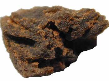
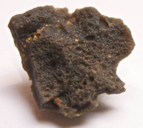
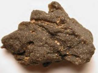
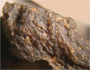
The glass is heterogeneous with a well-developed schlieren texture.
Individual schlieren have very different chemical compositions. There
are also digested quartz and feldspar grains.
El Goresy (1965) and El Goresy et al. (1968) showed that the glass contains
the high-temperature phases lechatelierite and baddeleyite. Beran and
Koeberl (1997) determined a very low water content of the glass.
Chao et al. (1966) and Koeberl & Auer (1991) found that the glass contain
high concentrations of Fe, Co, Ni, and Ir. Koeberl et al. (1998) reported
widespread fracturing and shattering of quartz grains in sandstone samples,
with subplanar and planar fractures being abundant. In addition, they
also described relatively wide and irregularly spaced fluid inclusion
trails, with several grains showing two sets of relatively straight
and closely spaced trails.
However, these authors concluded that this possible evidence of impact
was ambiguous: The fact that the fluid inclusion trails had been alleged
to be ��healed�� implied that they were in all likelihood pre-impact
features related to the metamorphic history of the rocks.
The petrographic analysis having failed to provide definite evidence
for impact in the form of optically identifiable shock-metamorphic indicators
and the results of previous chemical investigations remain ambiguous.
The chemistry points that this glass is an
rhyolitic melt
|
Oxide
(wt%)
|
Gucsik et al., 2004 |
Koeberl & Auer |
|
range (16) |
average |
range (7) |
average |
|
SiO2
|
81.70 |
87.5 |
85.67 |
84.90 |
86.90 |
86.04 |
|
Al2O3
|
6.85 |
9.60 |
7.76 |
6.36 |
7.57 |
6.87 |
|
TiO2
|
0.14 |
1.08 |
0.49 |
0.43 |
0.53 |
0.47 |
|
FeO
|
1.43 |
3.25 |
2.13 |
2.20 |
2.74 |
2.36 |
|
MnO
|
0.03 |
0.30 |
0.16 |
0.02 |
0.05 |
0.03 |
|
MgO
|
0.15 |
1.59 |
0.79 |
0.98 |
1.32 |
1.15 |
|
CaO
|
0.19 |
0.52 |
0.40 |
0.31 |
0.40 |
0.34 |
|
Na2O
|
0.02 |
0.39 |
0.11 |
0.17 |
0.27 |
0.23 |
|
K2O
|
1.61 |
2.19 |
1.83 |
2.06 |
2.56 |
2.32 |
|
|

|
|
|
|
|
|
|
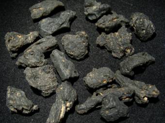
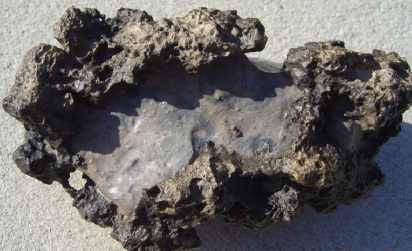
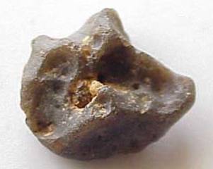
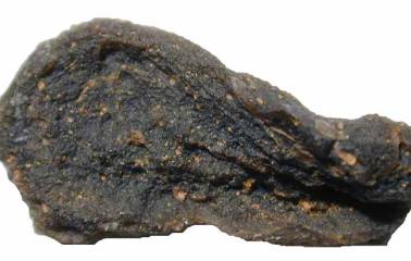
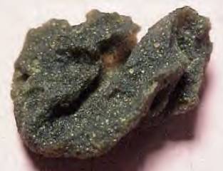
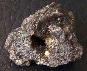
"Glass" with included differently
clasts
Source: www.carionmineraux.com
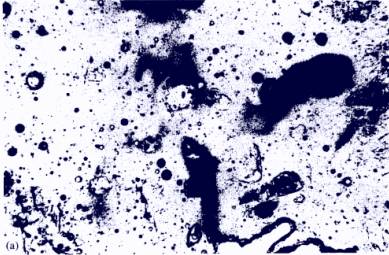
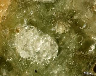
Aouelloul galss incude partly
melted mineral grains (predominantly digested quartz crystals)
|
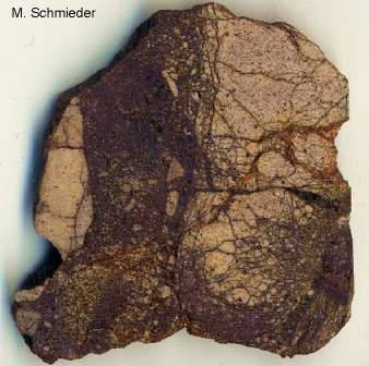
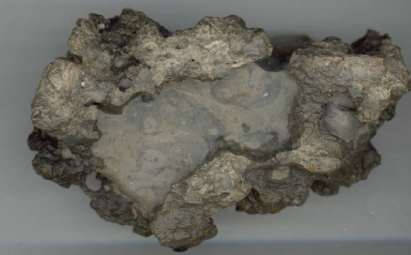
Demolished and impregnated sandstone
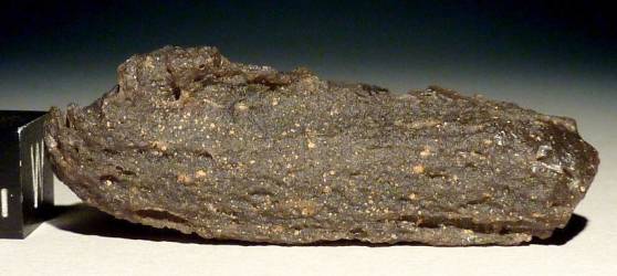
Aouelloul glass
|
|
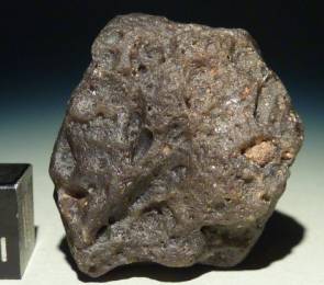
|
|
|
|
|
|
|
|
|
|
|
| Sources:
www.star-bits.com & www.meteoritearticles.com |
Crater Temimichat
|
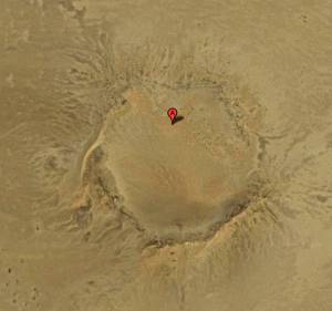
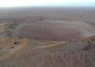
Crater Temimichat: Latitude 24�15'
N; Longitude 9� 39' W
|
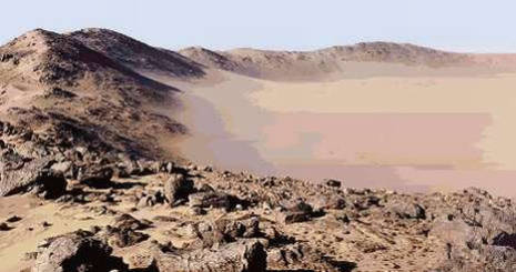
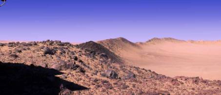
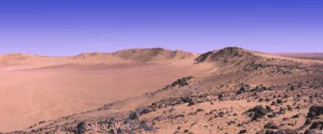
|
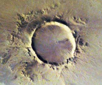
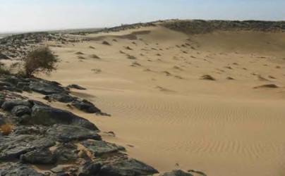
The
Temimichat crater is located in northern Mauritania (24�15'N, 09�39'
W). The bedrock is made up of crystalline basement rocks, with no sedimentary
cover. The structure has been listed together with other Mauritanian
craters or crater-like features. According to Pomerol (1967), mafic
rocks have been found in the area.
Basement rocks include granitoid gneisses and gabbros. The crater appears
moderately eroded, with a rim height ranging from few meters to few
tens of meters. Its diameter is about 700 m.The crater rim is not completely
preserved. Large portions are eroded and dissected, or masked by eolian
deposits. The rim is mostly formed by granitoid gneisses. The low-lying
portions of the rim correspond to the occurrence of gabbroic dikes,
which seem to be more easily erodible, with respect to the dominant
granitoid bedrock.The crater interior is covered by recent eolian Sediments.
Below this surficial cover, sedimentary deposits are likely filling
the crater.
Inside the granitoid gneisses of the rim, structures that strongly resemble
"pseudotachilite" veins crop out discontinuously, and do not occur in
the surrounding undisturbed basement. The term pseudotachilite is used
with a descriptive meaning only, not implying any genetic process.
So-called pseudotachilites are dark to greenish veins of glassy material
with fluidal texture at places. Inside these veins small (less than
1 mm size) fragments of the host rock are present. Pseudotachilite veins
mainly appear along small-scale faults, with offsets up to few centimeters.
Shear zones are also present, with a brittle to brittle-ductile style.
Inside the shear zones, appar-ently re-melted granitic clasts (with
dimension of few millimeters up to few centimeters) are visible and
their shape varies from angular to highly rounded.
The granitoid gneisses have an ipidiomorphic texture with a mineral
assemblage formed by quartz, K-feldspar, plagioclase, biotite and some
opaque minerals. The gabbroic bodies are composed mainly of plagioclase
and amphiboles.
No ejecta blanket appears to be preserved outside the crater. All around
the structure only eolian and fluvial deposits are present, with sporadic
large rocky blocks that are also visible farer outside the crater, in
the surrounding plain.
The time of formation of
the structure is still unconstrained, but the present erosional level
suggests a relatively old age of formation.
Conclusion: Temimichat crater
has been poorly studied during recent times. No ejecta blanket appears
to be preserved. The bedrock is formed of crystalline basement rocks,
mainly granitoid gneisses, with locally gabbroic bodies. Granitoid gneisses
locally show cataclastic deformation effects and are crosscut by dark
veins, that show a striking resemblance with pseudotachilites. Veins
are often pervasive. They are linked to small scale faults, with centimetric
to decimetric offset. Brittle or brittle-ductile shear zones are associated
with these veins, in which rounded granitic clasts also occur. Both
veins and shear planes appear fresh, suggesting a relatively young age
of formation. No regional brittle structures have been observed. The
basement deformational style is ductile and no recent
tectonic structures can
be observed in the area. These observation could be consistent with
the hypothesis of an impact origin (??) for these pseudotachilitic veins.
No cataclasites or vein appear in the gabbros.
Source: www.lpi.usra.edu/meetings/lpsc2003/pdf/1882.pdf
|

Source: SaharaMet.com
|
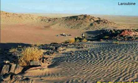
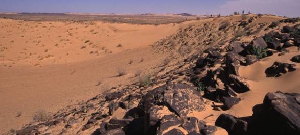
Crater rim
|
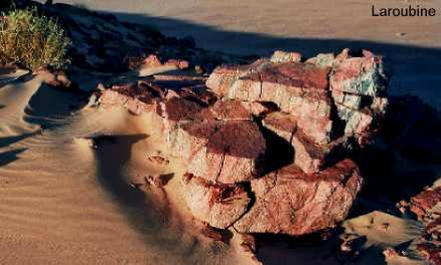
Uplifted and crushed granitoid
basement material
|
|
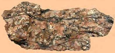
"Granitic rocks with dark glassy
veins are to be found at Temimichat"
Source: SaharaMet.com
|
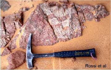
So-called pseudotachilite veins
along shear planes in a faulted granitic block
|
|
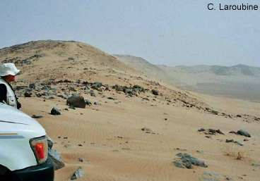
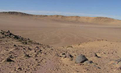
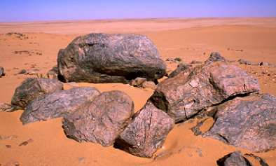
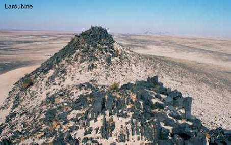
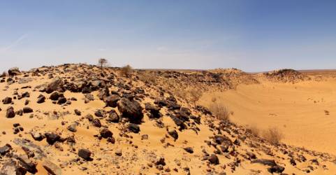
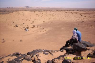
On the edges of the crater are distributes large blocks with shatter
cones (?) and such with glassy cover. Some blocks are pasted with a
characteristic glassy mass. Blocks of granite have been thrown on the
western crater-edge. In this area are numerous breccias visible. (Christian
Laroubine, 2005)
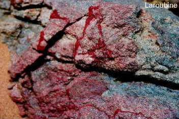
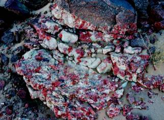
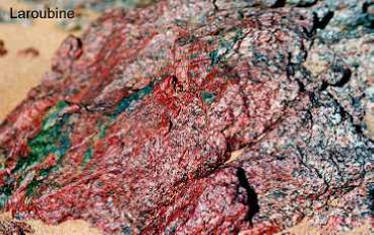
Granitoid rocks with marks of
fluid phases
|
|


