|
Fossile remains of genus Prasopora (Trepostomata
bryozoa) in Silurian strata of the Jabal Bzimah (Libya)
--- nearby Jabal Dalma (syn.
Jabal Zalmah) ---
Norbert
Brügge, Germany
Dipl. - Geol.
|
Jabal Dalma (Zalmah)
The
Howar-Uweinat Uplift forms the eastern border of the Kufra Basin. At
the northern part of this tectonic structure is located the Jabal Dalma
(Zalmah). The plateau contains sandstones, siltstones and shales of
Ordovician to Devonian age. In the southeastern part of the Jabal Dalma
are preserved transgressive Carboniferous strata with plant remains.
|
|
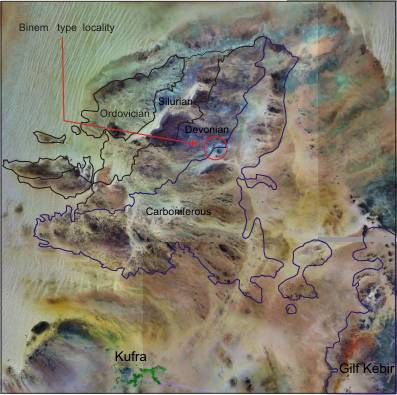
Geological map
|
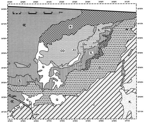
Lüning et al, 1999: Silurian sections
|
|
"Detailed outcrop
studies at the flanks of Kufra Basin reveal the nature of glacially-related
sedimentation and post-depositional deformation styles produced in association
with the Late Ordovician glaciation, during which ice sheets expanded
northward over North Africa to deposit the Mamuniyat Formation. At the
SE basin flank (Jabal Asba), the Mamuniyat Formation is sand-dominated,
and incises interfingering braidplain and shallow marine deposits of
the Hawaz Formation. The glacially-related sediments include intercalations
of mud-chip bearing tabular sandstones and intraformational conglomerates,
which are interpreted as turbidite and debrite facies respectively.
These record aggradation of an extensive sediment wedge in front of
a stable former ice margin. An increase in mudstone content northward
is accompanied by the occurrence of more evolved turbidites. A widespread
surface, bearing streamlined NW-SE striking ridges and grooves, punctuates
this succession. The structures on the surface are interpreted to have
formed during a regional north-westward ice advance. Above, siltstones
bearing Arthrophycus burrows, and Orthocone-bearing sandstones beneath
tidal bars testify to glaciomarine conditions for deposition of the
underflow deposits beneath. By contrast, the northern basin margin (Jabal
Dalma) is appreciably different in recording shallower water/paralic
sedimentation styles and major glaciotectonic deformation features,
although facies analysis also reveals northward deepening. Here, a siltstone
wedging from 8 to 50 m toward the north was deposited (lower delta plain),
succeeded by climbing ripple cross-laminated sandstones up to 60 m in
thickness (distal through proximal delta mouth bar deposits) with occasional
diamictite interbeds. These rocks are deformed by thrusts and > 50 m
amplitude fault-propagation folds, the deformation locally sealed by
a diamictite then overlain by conglomeratic lag during ultimate deglaciation.
Integrating observations from both basin margins, a model of fluvial-dominated
delta systems feeding a pulsed debrite and turbidite fan system in a
shallow proglacial shelf is proposed."
Sources: Le
Heron et al, 2009 and
Le Heron et al, 2010
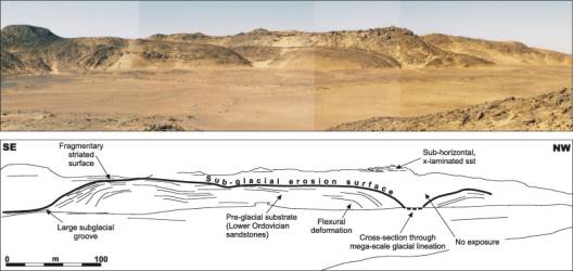

Glaciotectonic deformation
|
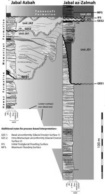
Late Ordovician (Hirnantian) glaciation
|
|

Glacial
traces.
Source: Lyell Collection
|
|
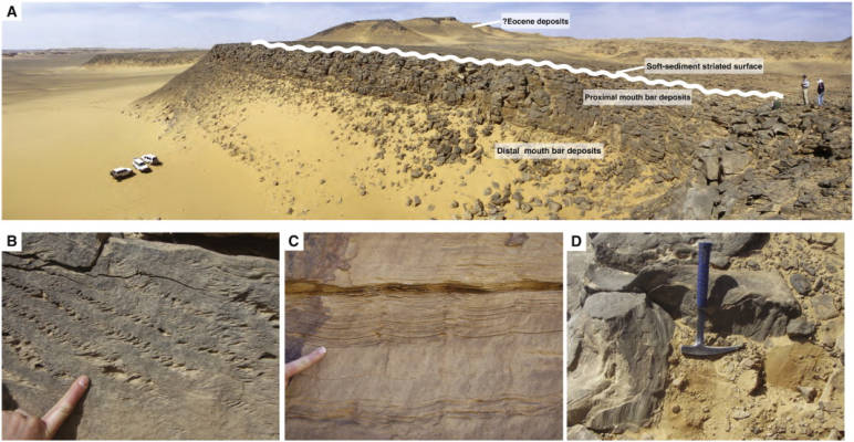
Facies details in the Mamuniyat Formation in the
northern part of Jabal
Zalmah
|
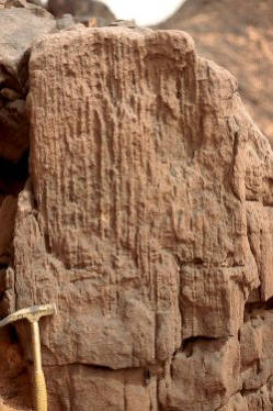
Skolithos (Tigillites)
|
|
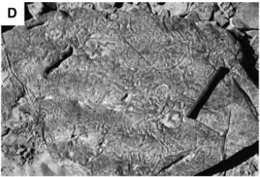
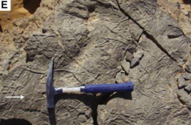
Typical surface tracks (Planolites) at the top
of the Mamuniyat Formation
|
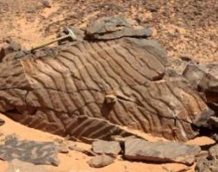
Ripple marks
|
"Field studies
in the Jabel Zalmah region, at the northern flank of Al Kufrah Basin
provide new insights into the stratigraphy and evolving depositional
environments of Cambro-Ordovician through Devonian sediments. At the
base of the succession, the Hawaz Formation is about 300 m thick and
is characterised by frequently Skolithos-burrowed, fine to medium grained
sandstones with occasional silty intervals and rare conglomerates deposited
in a generally high-energy tidal shelf setting. Bioturbation is pervasive,
and includes spectacular Cruziana traces produced by Early to Mid Ordovician
trilobites at the bottom and the top of the Hawaz Formation respectively.
These strata were incised during the late Ordovician (Hirnantian) glaciation.
Ice sheets flowing over Jabel Zalmah cut a palaeo-topography of up to
100 m relief. This relief is overlain by a coarsening upward succession
of clastic sedimentary rocks, recording re-advance of an ice sheet,
which overrode the uppermost sandstones. Ice sheet retreat was accompanied
by marine transgression and erosion, which left a thin transgressive
lag-conglomerate, capped sharply by siltstones of the Tannezuft Formation.
Progradation resumed after post-glacial maximum flooding, depositing
tide, storm, and river-influenced parasequences of a major delta complex
(200 m thick Acacus Formation). Fluvial incision, and the development
of a disconformity, preceded the deposition of the Tadrart Formation
(50 m thick), a succession of trough-cross bedded braided river deposits.
Transgression, and the re-establishment of shallow or marginal marine
systems, is represented by the extensively bioturbated Binem Formation
in which Zoophycos burrows offer a tentative Middle Devonian stratigraphic
fix.."
Source:
Le Heron et al, 2011
|
|
|
|
|
|
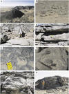
Outcrop character and sedimentary
facies of the Hawaz Formation in the westernmost
part of Jabel Zalmah.
A: view of ~ 200 m high outcrop representing the complete thickness
of the Hawaz Formation.
B: view of a large, composite sigmoidal bedform, built from trough cross-bedded
and planar laminated sandstones, at the base of the Hawaz Formation.
C: planar cross strata in medium-grained sandstone.
D: Skolithos burrows (vertical fabric) crosscutting planar cross-bedded
sandstones.
E: large-scale Thalassanoides trails.
F: Cruziana.
G: recumbent appearance of folded trough cross-strata (notebook for
scale).
H: large-scale overturned and folded cross strata. The scale of the
deformation allows a current shear mechanism to be ruled out, and a
liquefaction explanation is hence preferred.
|
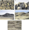
Typical features of the
Mamuniyat Formation at the contact with
the Tanezzuft Formation.
A: micro-fractured sandstones, interpreted to record deformation beneath
cold-based ice. B: chaotic folding within coarse-grained sandstone,
interpreted as soft-sediment, glacially related sediment deformation.
C and D: nature of the contact between the Mamuniyat Formation and the
overlying Tanezzuft Formation. This can be summarised as typically sharp,
yet undulose at the outcrop-scale.
E: Hummocky cross-stratified sandstones and interbedded siltstones at
the base of the Tanezzuft Formation. These facies are also common further
up section into the Acacus Formation.
|
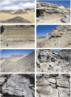
General outcrop views and sedimentary
facies within the Acacus and Tadrart formations.
A: typical outcrop pattern of the Acacus Formation.
B, C: beautifully exposed parasequences within the lower part of the
Acacus Formation.
D: sharp-based sandstone cutting down into underlying parasequence.
E: middle part of the Acacus Formation. In the background, each of the
clearly defined benches of sandstone mark the top of a 2-8 m thick coarsening
upward cycle.
F: discrete interval of Skolithos bioturbation, typical of the upper
Acacus Formation.
G: Arthophycus linearis (worm burrows).
H: cross-stratification in lower levels of the Tadrart Formation.
|
|
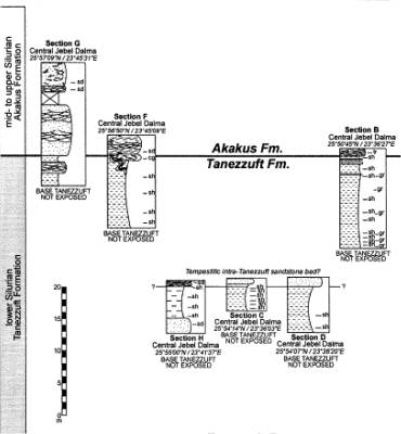
Sections G, F, H, C, D and B
(Lüning et al, 1999)
|
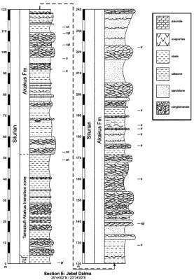
Section E
(Lüning et al, 1999)
|
|
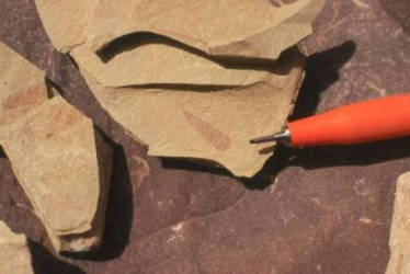
Early Silurian graptolites in the Tanezzuft shales in SE Libya (Jabal
Dalma)
Neodiplograptus fezzanensis (DESIO, 1940)
indicating a Lower to Middle Llandovery age
|
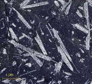
Sample of Diplograptus
|
Petr �torch (Department
of Palaeontology and Stratigraphy, Institute of Geology, Czech Republic) from
the Kufrah-Field Work 04/05 1999
found 22
samples of Graptolites from two localities in silty shales of the Jabal
Dalma Area in SE-Libya.
The present material is assigned in one of the most widely distributed and
most common North African graptolites - Neodiplograptus fezzanensis
(DESIO). The species was described from W-Libya by Desio (1940), later recorded
by Massa and Jaeger (1971) from the same area.
Diversity of the graptolite fauna is the lowest possible. All graptolite rhabdosomes
belong to single, though slightly variable biserial species Neodiplograptus
fezzanensis. Such monotonous, often monospecific, always diplograptid-dominated
assemblages are typical of the North African lower and middle Llandovery
strata and account for a rather restrictive environmental conditions (limited
or uniform food resources, lower surface temperatures). The same assemblage,
composed of a number of aligned rhabdosomes of Neodiplograptus fezzanensis
occurs also in shallow shelf sandstones.
Two trilobite exuviae assigned in Calymene aff. blumenbachi (BRONGNIART)
were found in a sample. The exuviae which are preserved in situ, without post-mortal
transport, suggest that some benthic faunal elements survived in presumably
oxygen depleted bottom environments on the Early Silurian North African shelves
and basins. Trilobites are associated with fragmented orthocone nautiloid
shell and graptolite rhabdosomes.
Benthic trilobites and nektic nautiloid shells which associate common though
uniform graptolite fauna may indicate some incursions of better oxygenated
water masses in presumably oxygen depleted offshore environment. Graptolite
diversity was strongly restricted by local environmental patterns in this
facies.
The found trace fossils recorded in a sample belong probably to Cochlichnus
and Protovirgularia ichnogenera and account for a shallow water
environment of tidal flat or related facies.
In the area of Jabal Dalma the Devonian sediments outcrop with thicknesses
generally greater than the southern areas. The Lower Devonian outcrops are
discontinuous while the Middle-Upper Devonian outcrops form a large, continuous
belt, of approximately ENE direction, from Jabal Qardabah to the southern
edge of the Tertiary onlap.
Tadrart Formation.
These formation is well exposed in a narrow belt of about 60 km N and NNW
of Jabal Dalma. In other areas, the Binem directly overlies the Akakus. Lower
Devonian sediments are represented by sandstones, quartzitic, coarse- to medium-grained,
dark reddish to yellowish, with kaolinitic and ferruginous cement, locally
with interbeds of very fine sandstones and micaceous siltstones, soft and
greyish, or of dark, hard ironstone.
In the upper part the beds are 30-50 cm thick while, towards the base, the
thickness increases rapidly to 2-3 m. The sandstones are normally cross-bedded
and with parallel laminations and foresets. The Lower Devonian Sediments of
this area seem to represent mostly the Tadrart. The greatest thickness of
100 m and partial thicknesses of 22 and 25 m were measured.
Binem Formation. In the northeastern side the Binem Formation outcrops
over large extensions, forms low reliefs and is quite dismembered by faults;
the total thickness must be measured on various dissected and scattered hills.
In this area the thickness of the Binem Formation increases considerably and
shows some lithological changes with respect to the southern areas.
The main lithological changes refer to the occurrence of arenaceous, multicoloured
clay in the lower part of the formation, with thicknesses of some tens of
metres and the occurrence of slightly silty clay in the highest part of the
formation with a thickness of over 22 m. These silty, greenish, laminated
clays, locally with Brachiopoda, have been found in two sections. The
best exposures of the Binem Formation are at four sections with thickness
of 60 to 125 m.
Fossil traces are locally extremely abundant and represented mainly by
Zoophycus. Asterosoma sp. is sometimes common at the bottom of
sandstone beds overlying clay or siltstone. The most important fauna was found
at a section in central part of Jabal Dalma. At 25�47' 50"N and 23�52'
30"E of the Binem type locality displays nuculouid bivalves oft he genus
Kufralana and Paleoneilo of lagoonal to deltaic facies and some Gastropoda.
(Termier et al. 1980).
|
Le Heron et al, 2012: High resolution
facies analysis and sequence stratigraphy of the Siluro-Devonian succession
of Al Kufrah basin

Source:
ScienceDirect.com - Journal of African Earth Sciences
|
General view of the Silurian and
lower Devonian strata in Jabal Zalmah (N25�43'37" - E23�33'59"). The
uppermost part of the Tannezuft formation and the Akakus formation is
mostly exposed along extensive cliffs and consists of heterogeneous
shale to fine-grained sandstones in which 8 m-thick massive sandy bars
have been observed and used as regional stratigraphic markers. Benches
are interpreted as being equivalent shoreface storm dominated deposits
(bars A, B, D, F and G) or tidal flat to estuarine deposits (bars C,
E and H). Bars are sharp-based with underlaying heterogeneous inter-bars
and represent key stratigraphic forced regression surfaces. Lower Devonian
fluvial sandstones of the Tadrart formation (red strata) unconformably
overlie Silurian Akakus formation

Regional correlation
transect of the Siluro-Devonian succession between Jabal Zalmah and
Jabal Asba. Geographical coordinates of section 2 (N25�43′37″
- E23�33′59″), section 4 (N23�11′02″ - E24�29′21″) and section 5 (N22�55′17″
- 24�20′58″).
|
|
|
|
|
|
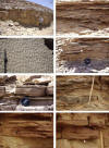
The uppermost Tanezzuft formation
and the Akakus formation successions contain storm-related deposits.
(a) Amalgamated hummock cross-stratified fine-grained
sandstones forming massive sharp-based equivalent shoreface deposits
(Jabal Zalmah).
(b) Amalgamation of symetrical vortex straight-crested oscillatory ripples
in fine to medium grained sandstones (Jabal Asba).
(c) Interferent polygonal co-genetic ripples or
�bricks and tiles� pattern-like ripples (Jabal Zalmah).
(d) Stacked assymetrical climbing ripples sets forming centimetric thick
tabular sandy beds. Facies may include �ball and pillow� structures
(Jabal Asba).
(e) Details of an aggrading pattern of in-phase symmetrical climbing
ripples within well-sorted fine sandstones (Jabal Asba).
(f) Teichnicus sp. burrowing a thin wave-rippled sandy bed (Jabal Asba).
(g) Tabular millimetric-thick silty sandy benches interbedded with muddy
siltstones (distal upper offshore).
(h) Details of undulated fining-upward storm graded sandy and silty
layers burrowed by Skolithos sp. (distal upper offshore).
|
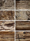
Bars C, E and H of the Akakus
formation in Jabal Zalmah and the uppermost part of the Akakus succession
in Jabal Asba constitute sharp-based tide-related strata.
(a) Highly bioturbated horizontal and tabular
decimetric thick sandy sheets (Jabal Zalmah).
(b) Bioturbated cross-bedded fine-grained sandstones with planar foresets
of megaripples (Jabal Zalmah).
(c) Lee side face tangential foresets of migrating megaripples scoured
at the top by erosive surface (Jabal Zalmah).
(d) Close-up of lingoid crested unidirectional current ripples train
(Jabal Zalmah).
(e) Concave-up scour surface truncating a stoss-side megaripple, underlain
by wave-generated ripples (Jabal Asba).
(f) Aggrading in-phase symmetrical climbing wave-generated ripples into
a fine to medium � grained sandy bench (Jabal Asba).
(g) Lenticular to wavy bedding in a muddy to fine-grained sandstone
assemblage (Jabal Asba).
(h) Small asymetrical gutter cast located at the base of a centimetric
thick coarse � to medium � grained cross bedded sandy bed (Jabal Asba).
|
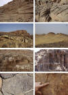
Photographs illustrating facies
of the Tadrart and Binem formations.
(a) Massive reddish fluvial cross bedded sandstones of the Tadrart formation
(Jabal Asba).
(b) Details of planar cross-stratified fine-grained
sandstones (fluvial bar preserved in the Tadrart formation) (Jabal Zalmah).
(c) Heretogeneous hummocky cross-stratified succession of the Akakus
formation truncated by reddish cross bedded fluvial Tadrart formation
sandstones (Jabal Zalmah).
(d) Illustration of the top Silurian�base Devonian unconformity at the
Akakus�Tadrart formations transition (Jabal Zalmah).
(e) Cross-bedded sandstones of the middle Devonian Binem formation significantly
affected by numerous Skolithos sp. burrows (Jabal Asba).
(f) Close-up of a �Tigillites� facies in the Binem formation (vertical
burrowing of long Skolithos ichnofabric) (Jabal Asba).
(g) Zoophycos sp. significantly preserved into the uppermost Binem formation
(Jabal Asba).
(h) Spirophyton isp. preserved into the uppermost part of the Binem
formation (Jabal Asba).
|
On account of their lithological, sedimentological, palaeontological and environmental
characteristics they were referred to the Dalma Formation (from the
high hill of Jabal Dalma (Zalmah), NNE of Kufra with coordinates: 25�34'10"N
and 23�55'15"E. The Carboniferous sandstones form the highest reliefs of the
Palaeozoic outcrops and it is in one of these, at Jabal Dalma, that the type
section has been chosen for the Lower Carboniferous in the Kufra basin.
The sequence exposed at Jabal Dalma, however, is not representative of the
whole formation and the reference section must be completed with some additional
sequence which outcrops southwards, in scattered hills: section (25�14' N
and 23�46'30�E), section (25�08'20�N and 23�49'15"E) and section (25�12' N
and 23�45' E).
The outcropping of the Dalma Formation is here reduced by erosion and the
unconformable onlap of the Continental Mesozoic.
At Jabal Dalma the outcropping section is 388 m thick. The base of the relief,
and of some nearby reliefs, is represented by sandstones, quartzitic, whitish,
slightly argillaceous and poorly cemented and generally thin bedded. These
sandstones unconformably overlie the Devonian greenish shales and siltstones,
sometimes with Brachiopoda. Upwards they are overlain by about 290
m of sandstones, quartzitic, coarse- to fine-grained, brown-reddish to yellowish
and greyish, generally poorly cemented and thick-bedded, cross-bedded, with
some irregular bed or lenses of fine, whitish to pink quartz conglomerate.
Uncommon plant remains, mainly Lepidodendron, are found here.
The upper 90 m are formed of interbeddings of sandstones, as above, generally
very thick bedded, and shales and siltstones, slaty, very hard, dark reddish-violet
to grey, sometimes with common traces of Licopodophyta (Lepidodendron,
Sigillaria etc.).
In contrast the outcrops of another section are represented by over 50 m of
shale, greenish, silty, soft, fissile, with interbeddings (l 0-30 cm) of sandstones,
fine-grained, hard, with abundant ferruginous cement, oolitic and fossiliferous
(small Pelecypoda and fossil traces). Southward, these sandstones and silty
shales are unconformably overlain by the Continental Mesozoic.

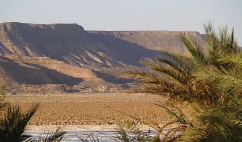
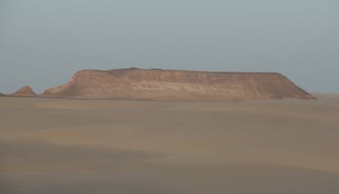
Lost Oasis Bzimah
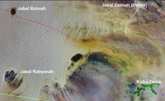
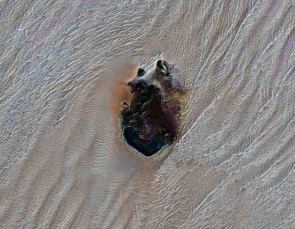
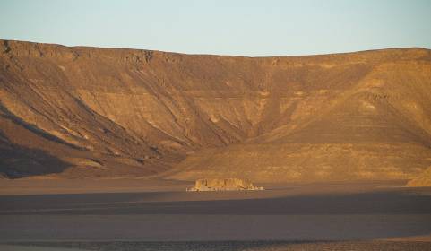
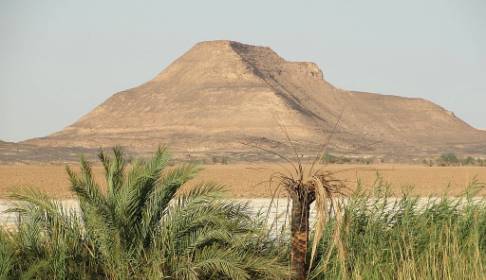
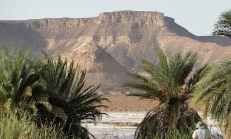
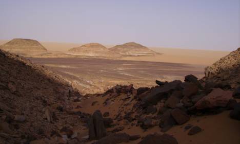
The Jabal Bzimah is
an isolated sandstone - plateau, located outside in the desert nearby Jabal
Dalma (Zalmah). During a trekking - tour in 2005 we had a camp at the Jabal
Bzimah. This plateau is found approximately 70 km in distance from the Jabal
Dalma. The upper part of the deposits are partly massive reddish sandstones.
The lower part of deposits included differently silty shales.

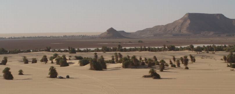
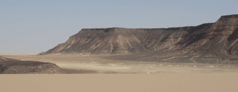
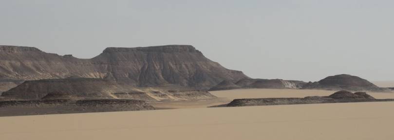
The plateau of Bzimah
probably was uplifted in the Upper Devonian period by the Bretonian tectonic
event. The reddish sandstones are stratified thick and thin. Cross-beddings
are not rarely available. The lower part of the mighty profile contains frequently
siltstones.
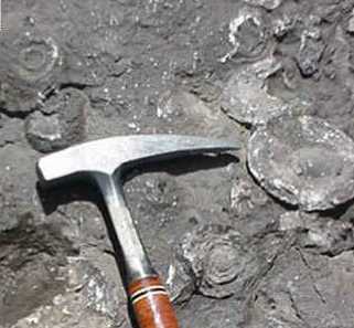
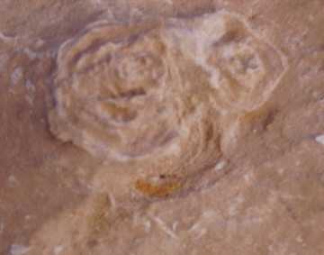
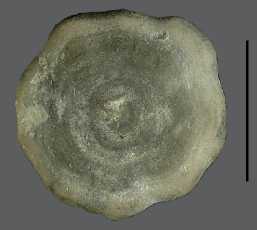
During a short-time excursion I have searched fossils. I have found only some
remains of Silurian bryozoa of Genus Prasopora in thin layers
of sandstones above the siltstones. Bryozoans (Moss Animals) are sessile aquatic
animals forming mosslike colonies of small polyps. Each having a curved or
circular ridge bearing tentacles and reproduce by budding. Bryozoans are found
in the deeper intertidal to subtidal zones, attached to firm substrate, and
also in brackish water.
|

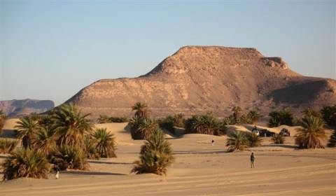
Massive
Devonian (?) sandstone on the plateau
|
|
|
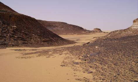
Silty shales
of Silurian Tanezzuft Formation
|
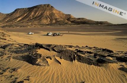
Silty shales in the foreground
|
|
|
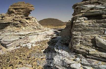
Silty shales
on base the sandstones
|
|
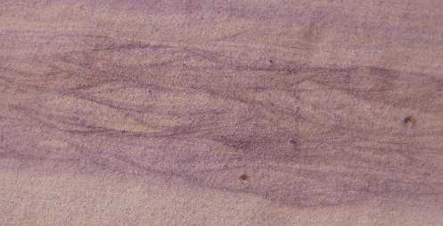
Flat water
Turbulences
|

Cross-bedding
|
|
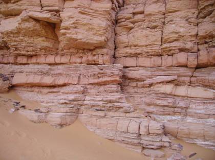
Thick and
thin layers of Silurian sandstones of Akakus Formation
|
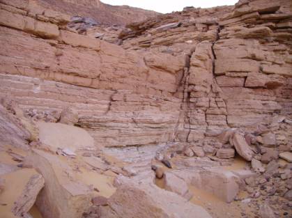
with remains
of Prasopora bryozoa
|
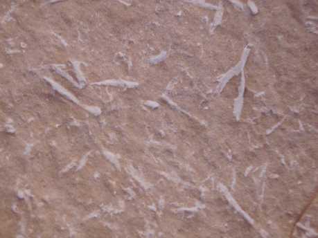
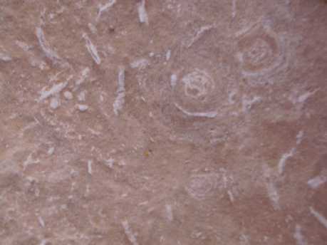
Bryozoan remains
in a shallow marine sandstone of Jabal Bzimah
|


